|
 |
||||
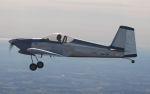
A good friend of mine from college was having a birthday weekend along with a bunch of friends coming from all over to converge in Detroit, MI. I of course was game on going, although since I prefer to use the RV instead of my airlines, my attendance was weather dependent. Unfortunately the weather didn't work out for me to spend the entire weekend in Detroit, but it did allow for one night. My route out there was to hang south of the Pittsburgh class B airspace, then hook up to Toledo, cross over Ann Arbor and then finally to the Oakland/Troy airport (KVLL). 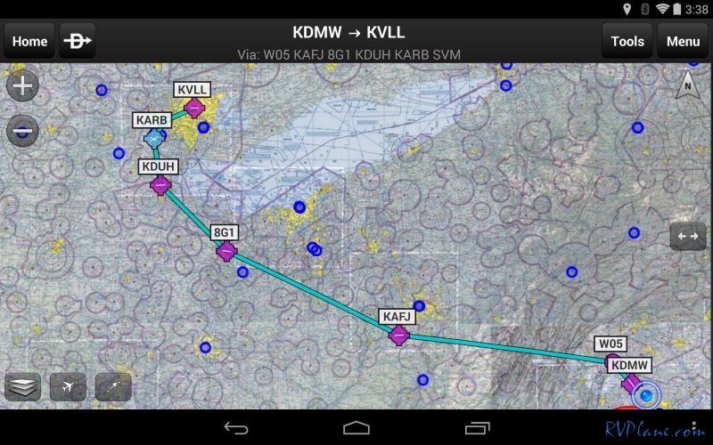 At KDMW the skies were as clear as they could be - the temperature was another story...16 degrees on the ground! It was going to be a cold flight and I was prepared for it with a lot of layers of clothing. 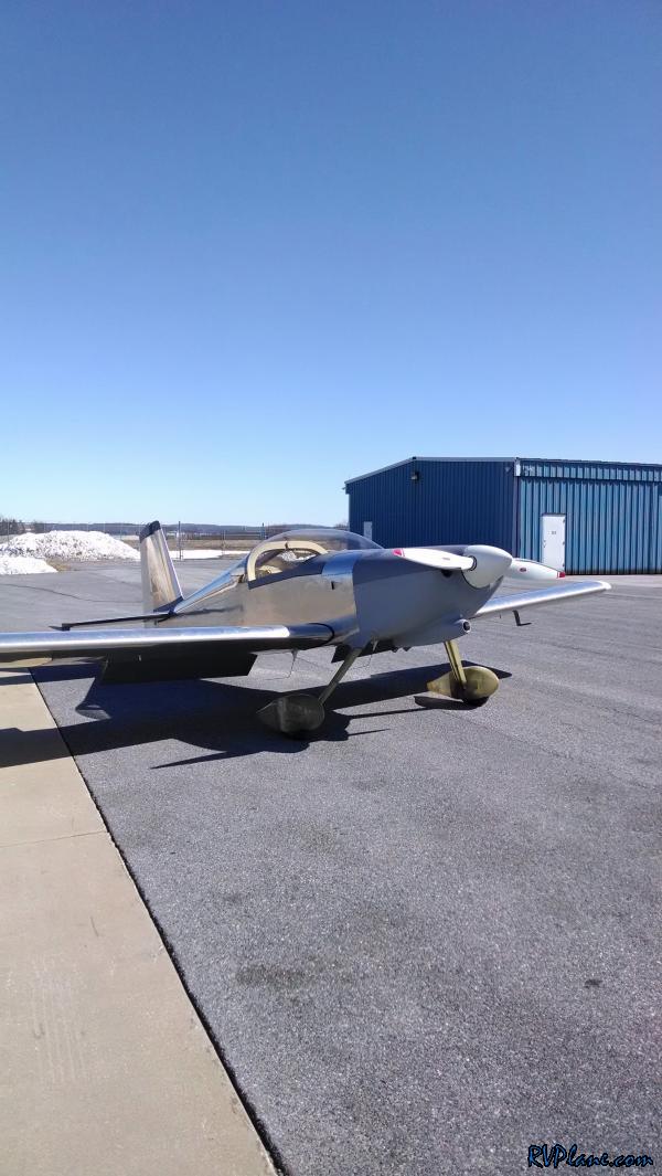 In the air I went. The first thing I noticed was my Garmin 430W lost GPS signal briefly right after takeoff. To be honest I have no idea what happened - it lost all of the GPS signals, but then they all came back slowly. For the remainder of the trip it was rock solid. A friend of mine let me know the government frequently jams the GPS signal in the vicinity of Camp David when VIP's are moving. So I am attributing my brief outage to this. 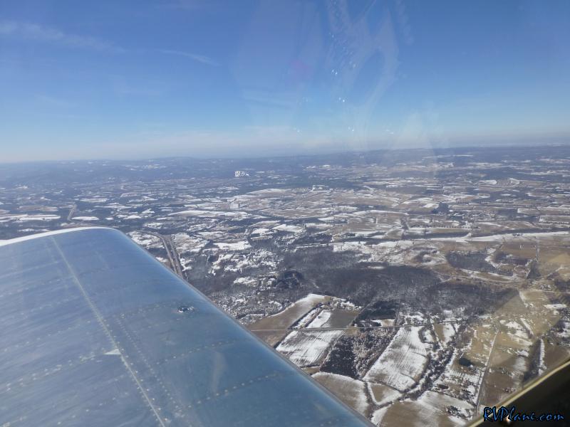 As cold as it was on the ground...it was colder in the air. The lowest OAT I saw was 1 degree F. 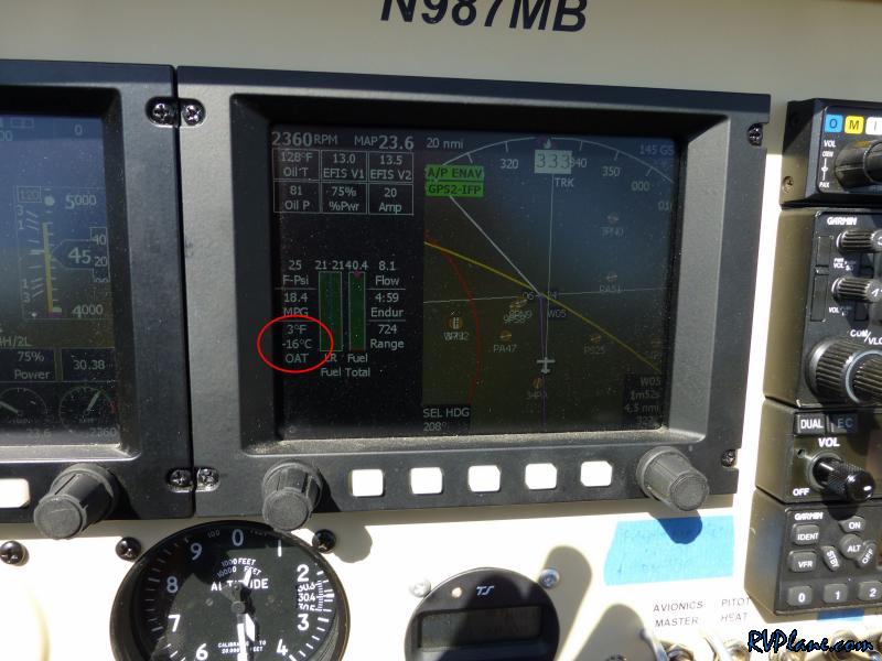 My engine was struggling to keep warm. Oil temps were in the high 120's, CHT's were in the mid 200's. 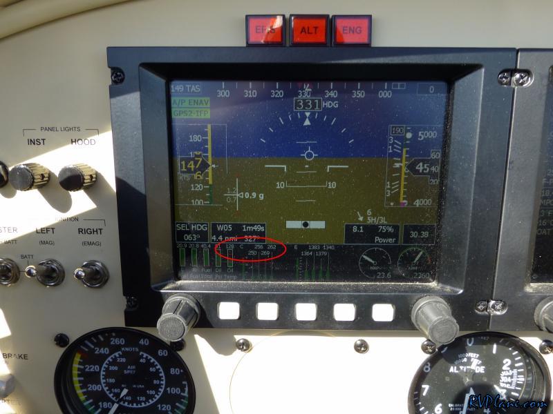 Passing a wind farm in PA. 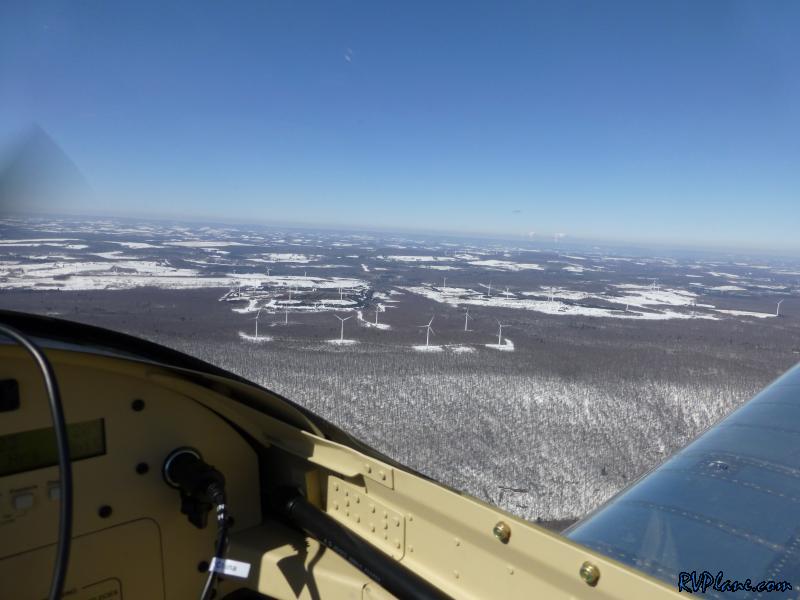 I noticed that the level to engage my oil cooler blocker would slightly open over time. It was opening enough to cause a fluctuation of about 10 degrees in the oil temps. I didn't have any string with me, but I used an extra 1/8" audio cable to force it to stay open. It seemed to make a difference. 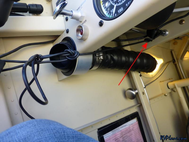 Passing over Somerset, PA. 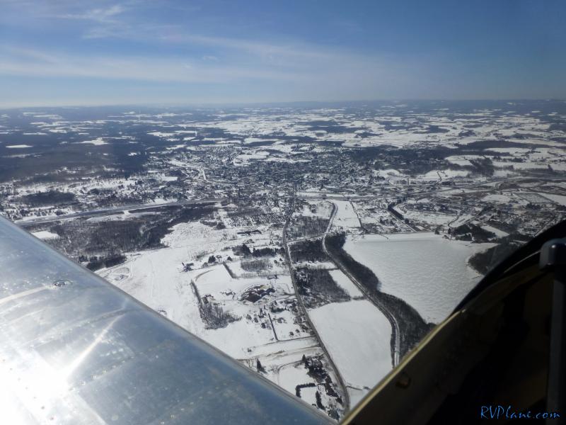 What's going on here...a tailwind heading west? Hey, even if it's only 2kts, I'll take it. 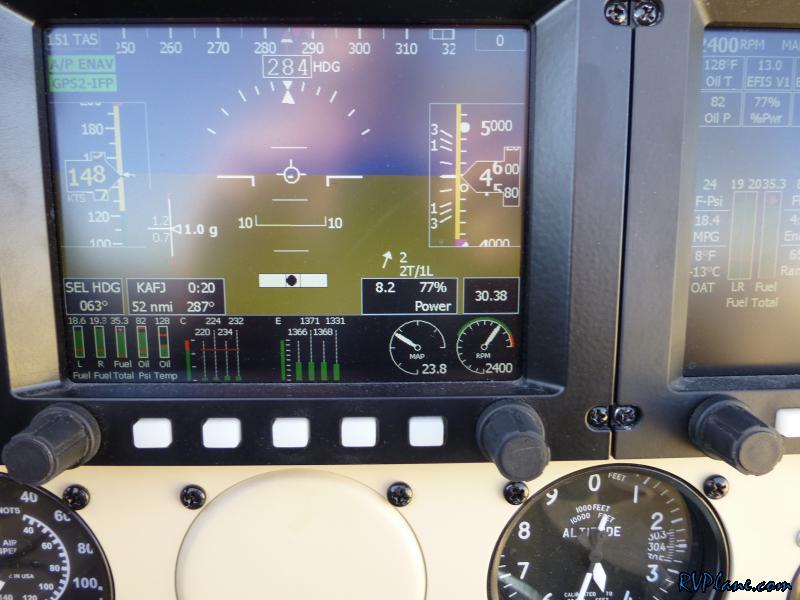 Seven Springs ski resort. This was the destination for my annual ski trip in high school. Good memories. 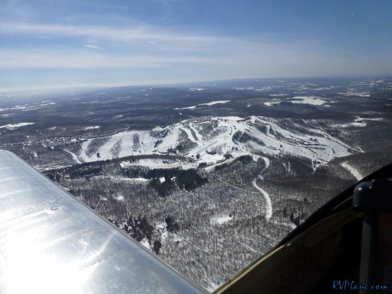 Another shot of Seven Springs. 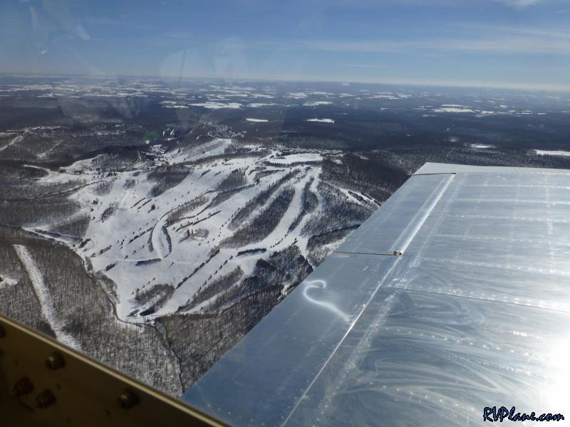 Coming up on the Ohio River. It blows my mind still how quickly the RV scoots through the air. 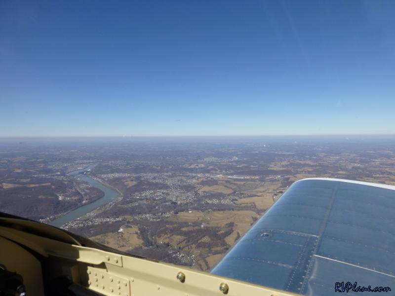 This was my first trip using the Garmin GDL-39 and the Android Tablet running the Garmin Pilot app. While it has taken some time to get used to this app from using ForeFlight, I am very happy with the performance and usability. 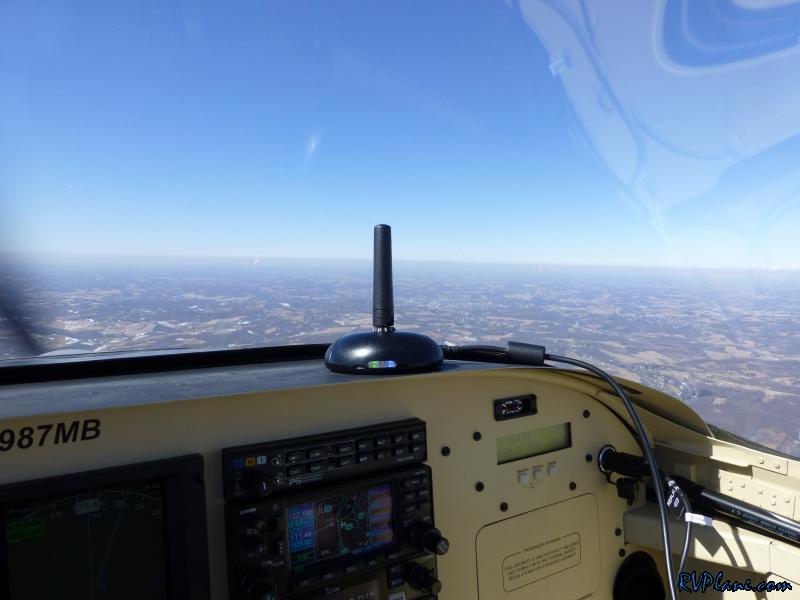 The screen on the new (2013) Google Nexus 7 is great in the RV cockpit. Even on a bright sunny day like today, the screen never washed out and was completely usable. 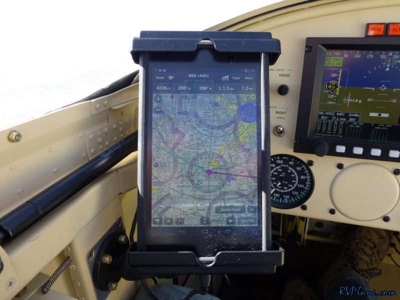 The Cardinal coal power plant in Brilliant, OH 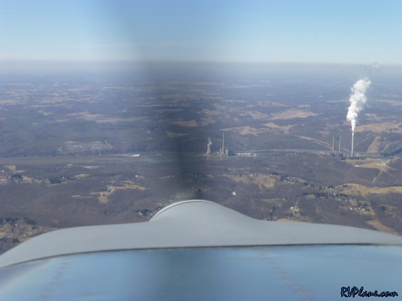 Over the power plant. The visibility was just awesome today. 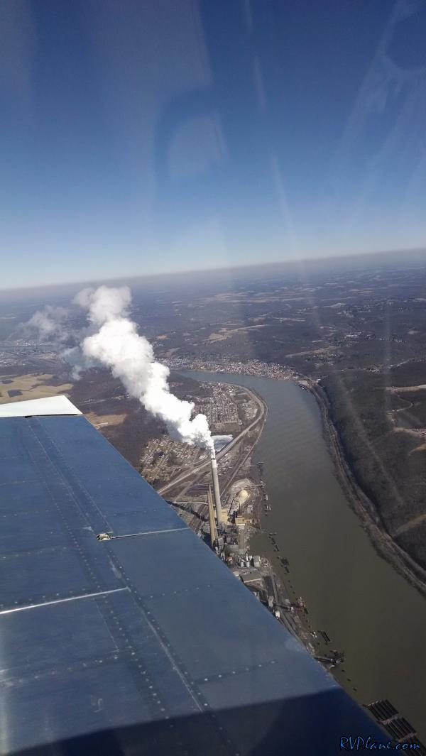 Tappan Lake in OH. 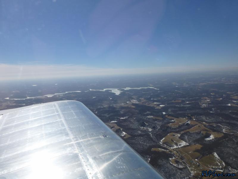 The temps seemed to be getting warmer....at least it's in the double digits! 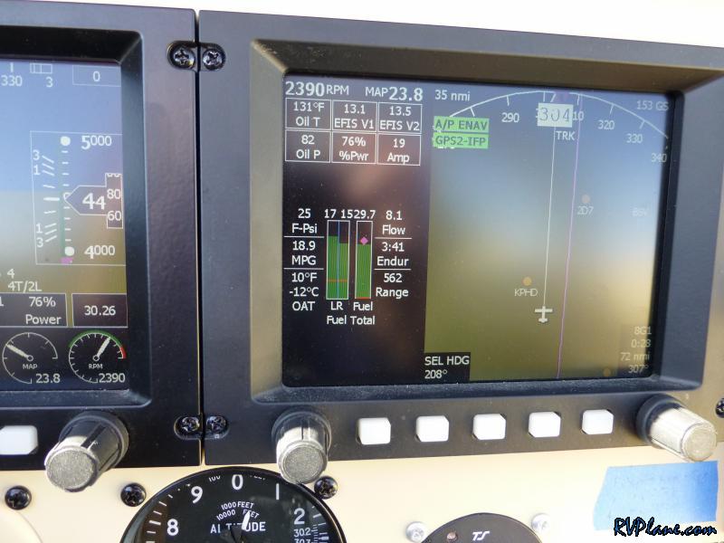 One of the few clouds I saw all day. 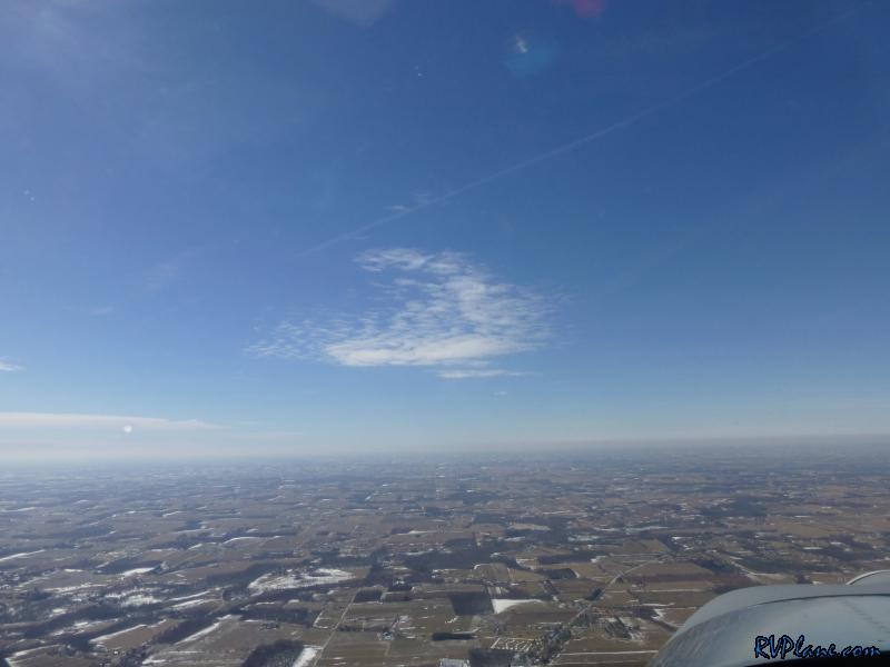 Now I am just getting spoiled...8 kts tailwind heading West? 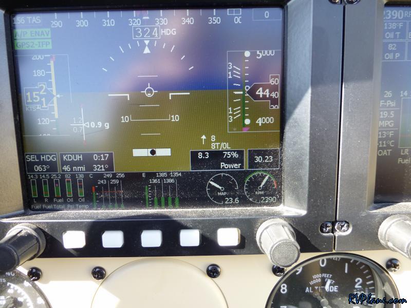 Coming up on Lake Erie. 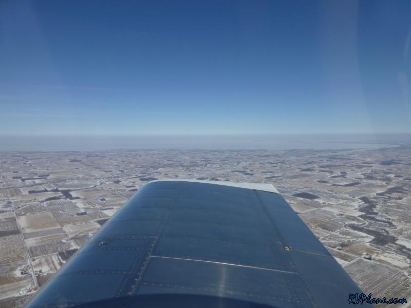 Toledo, OH. 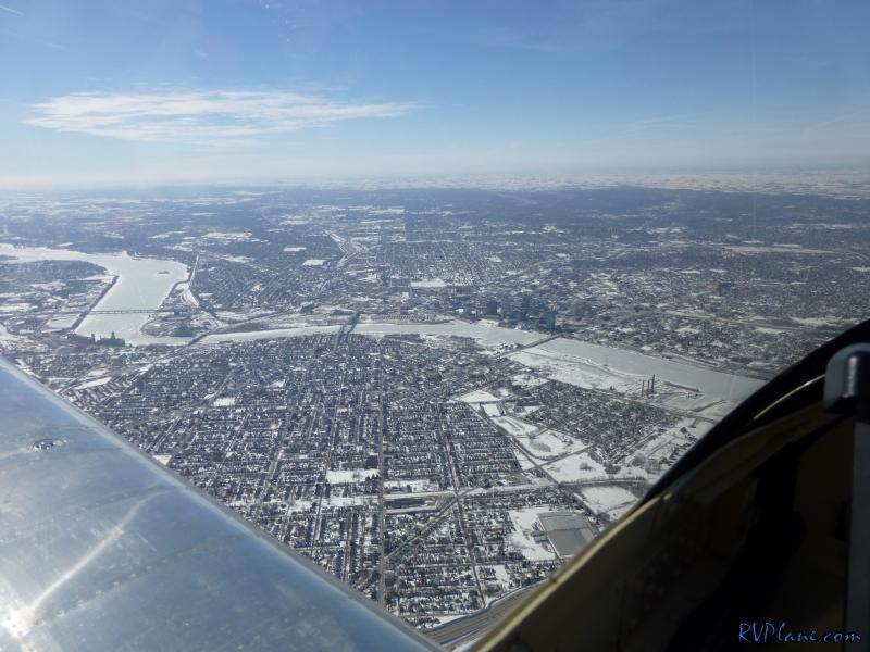 Lake Erie seems mighty frozen. 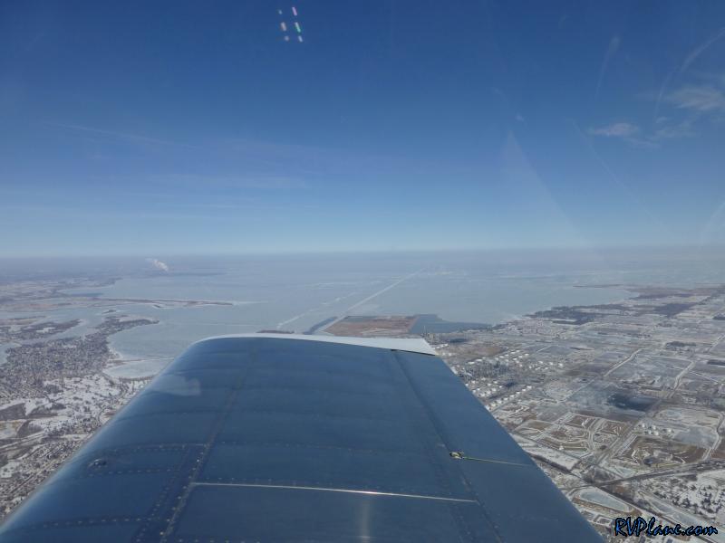 I am guessing this white line in the ice is the path ice breakers and merchant ships take in and out of the Toledo port. 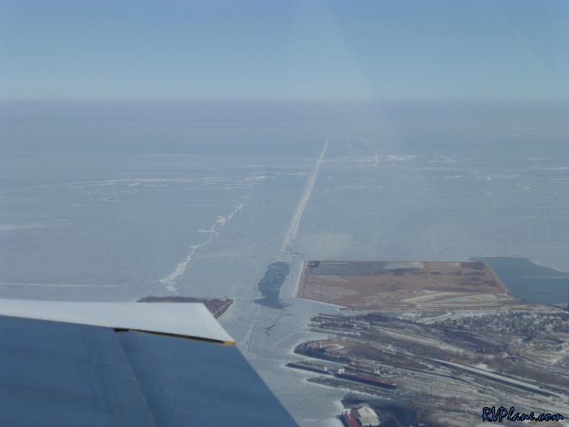 As soon as I crossed into Michigan the ground got a lot more snow covered. 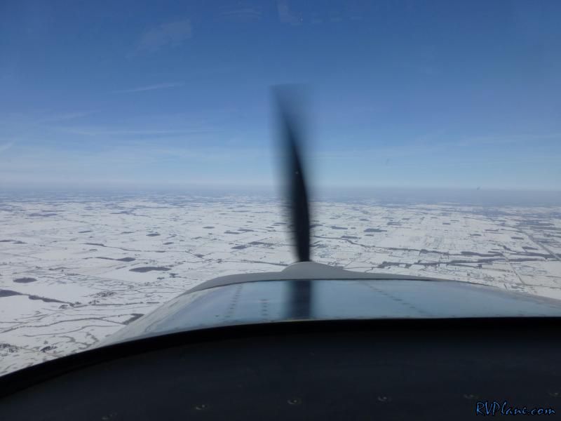 12 kts tailwind now heading North. 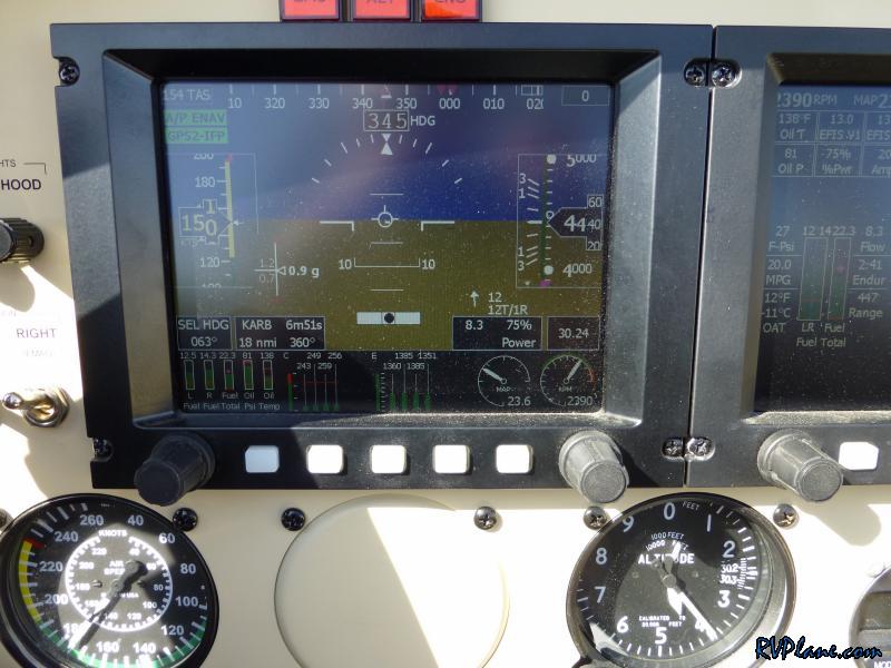 Detroit Metro airport (KDTW) off to the east. 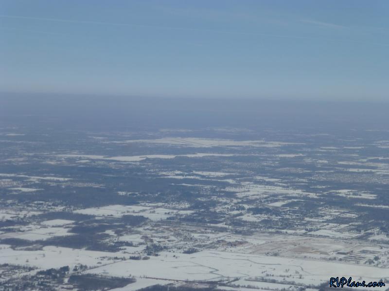 In no time the winds changed to a 21 kts tailwind. 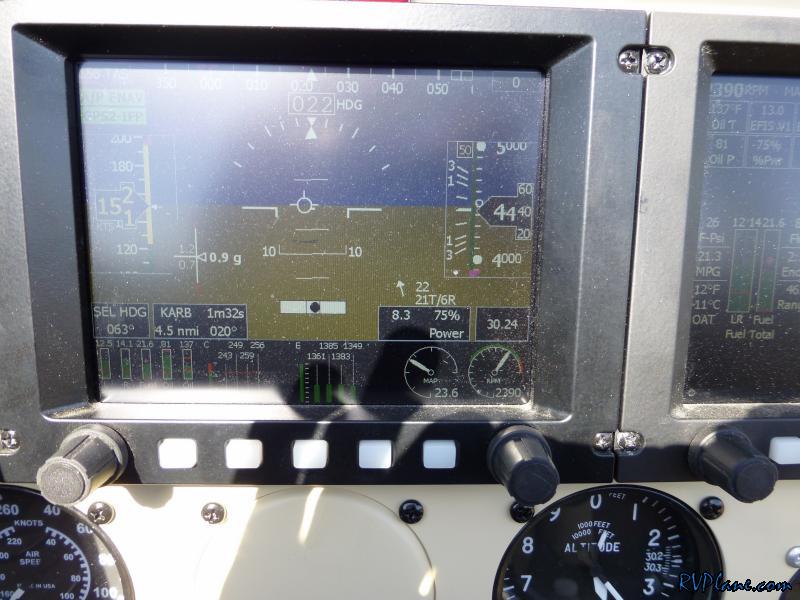 Zooming at 177 kts across the ground. 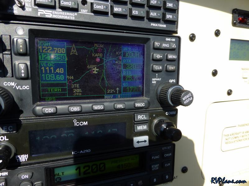 Ann Arbor, MI 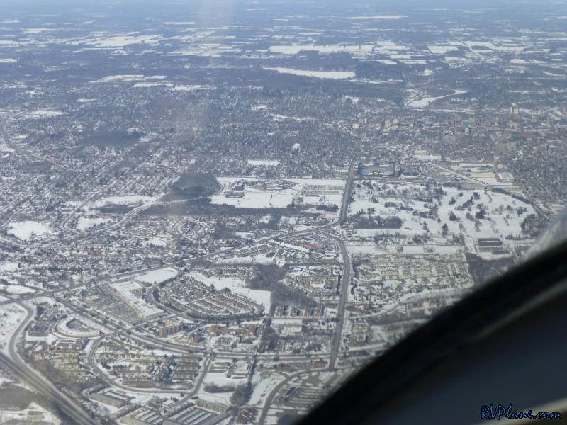 University of Michigan's football stadium. 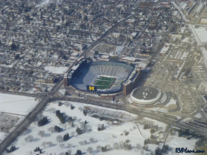 Less than 18 hours after I landed it was time to head back home. Just North and West of KVLL was already IFR, and I knew it was heading my way. South and East were all clear. My route home was basically the same, except I was trying to make it to one of our EAA chapter lunches in Reading, PA - so there was a slight detour on the way home. 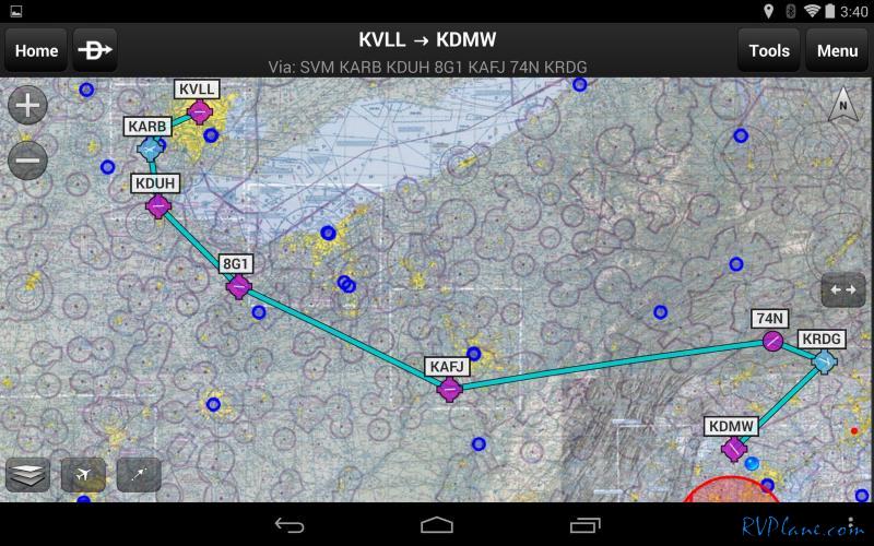 Roadblock #1 - the airport was closed when I got there! It was supposed to be open at 8am, but not a soul was there. I should of copied down the code to the gate. Luckily the fence was short and the snowbanks were tall, so over the fence I jumped. As I was getting the RV ready, the flurries started to come. As I was taxing out to the runway the snow was getting more intense. I was listening to the AWOS and the visibility went from 10 miles to 4 miles between reports. It was time to get off the ground! 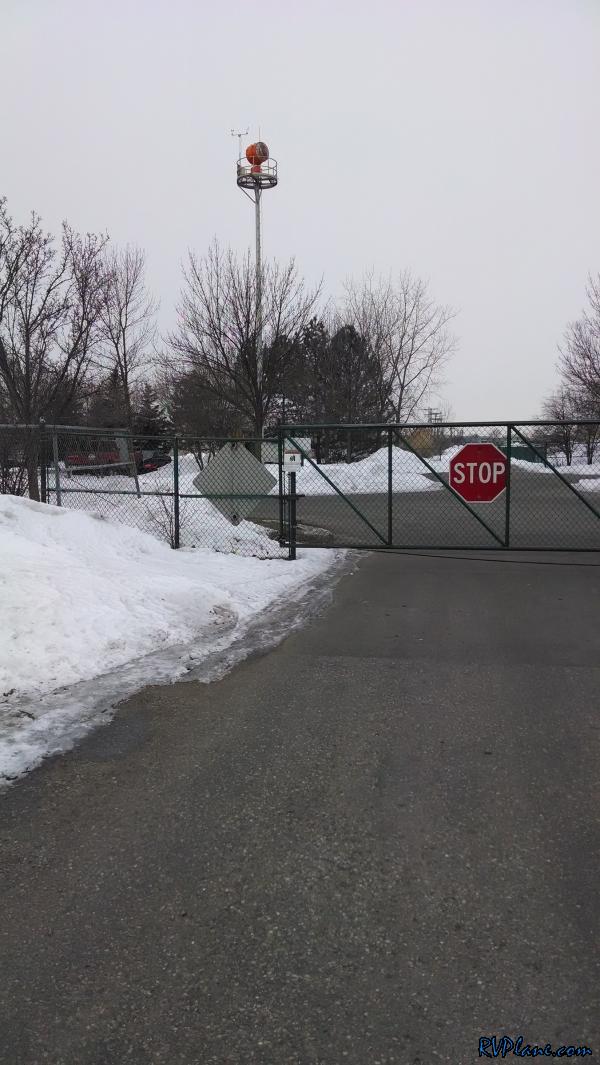 I blasted off into some low visibility weather. It was VFR, but not by much. I knew there was better visibility ahead. 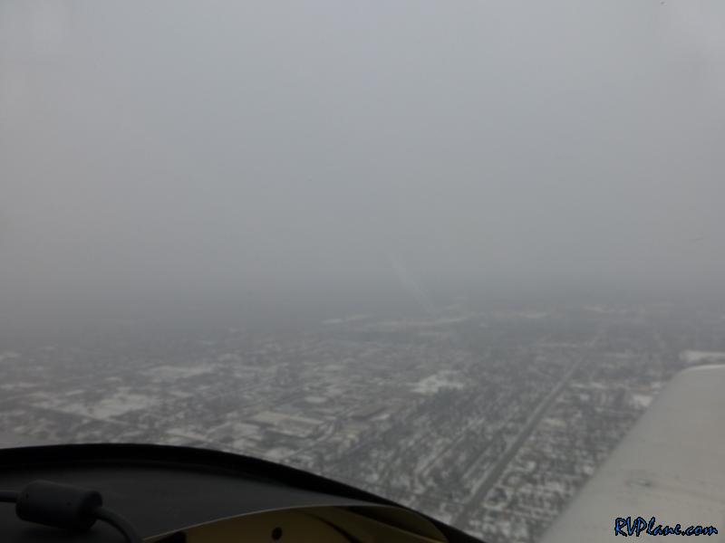 Sure enough no more than 3 minutes after take off everything was clear. Downtown Detroit is to off to the distance. 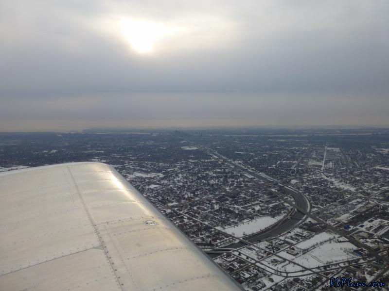 Somewhat close-up of Detroit, with Windsor Canada to the far side of the river. 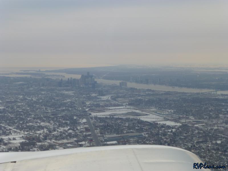 The cruise down the side of the Detroit river was quite nice and scenic. 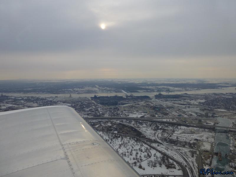 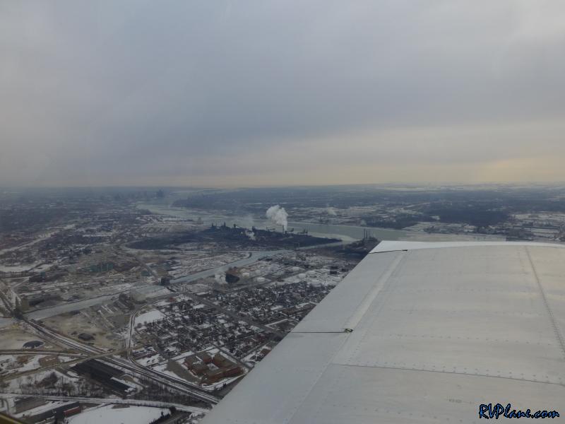 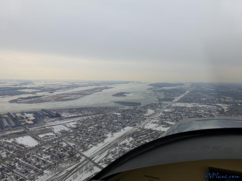 The OAT was much more reasonable today - 30 degrees at 2,300'. 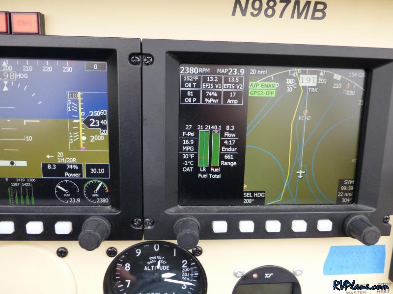 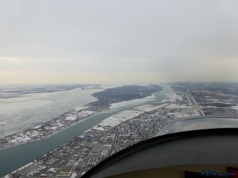 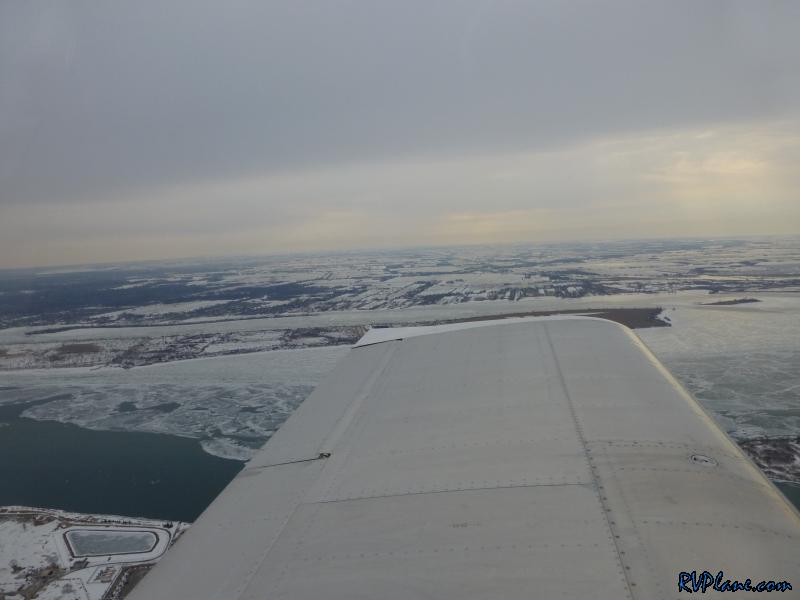 The Grosse Ile Municipal airport (KONZ) off to the left and the Trenton Channel coal burning power plant underneath me. 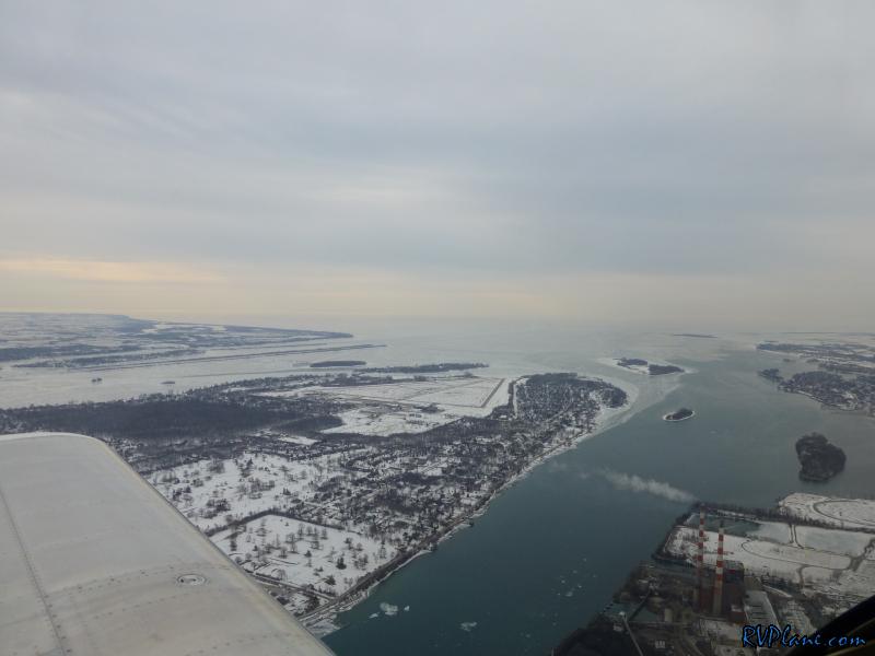 Looking out over lake Erie. 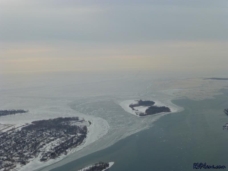 The Enrico Fermi Nuclear power plant. Fun facts about this power plant - it was named after the Italian nuclear physicist Enrico Germi. It was also the first Nuclear plant to be toured by an actively campaigning presidential candidate (John McCain in August, 2008). 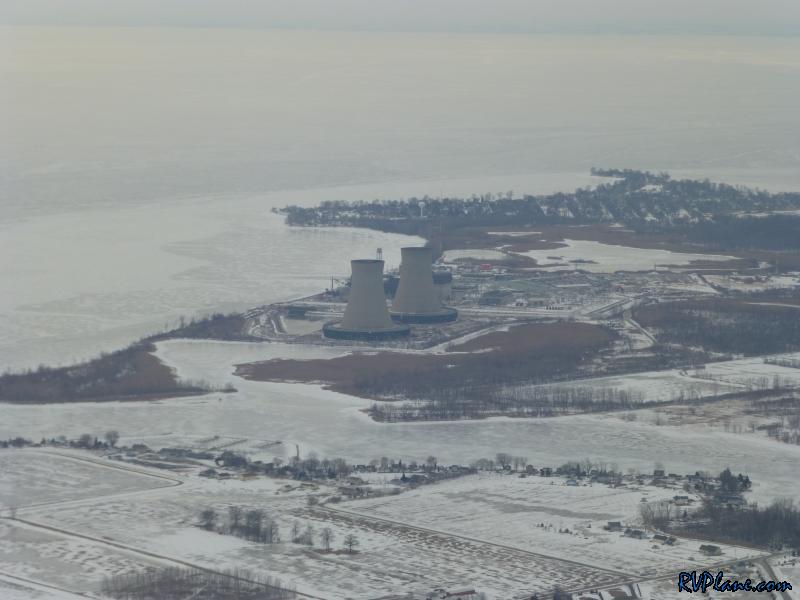 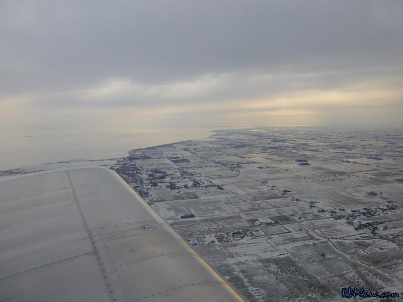 This was pretty much as exciting as it got on the way home - a thin layer of clouds at 7000'. 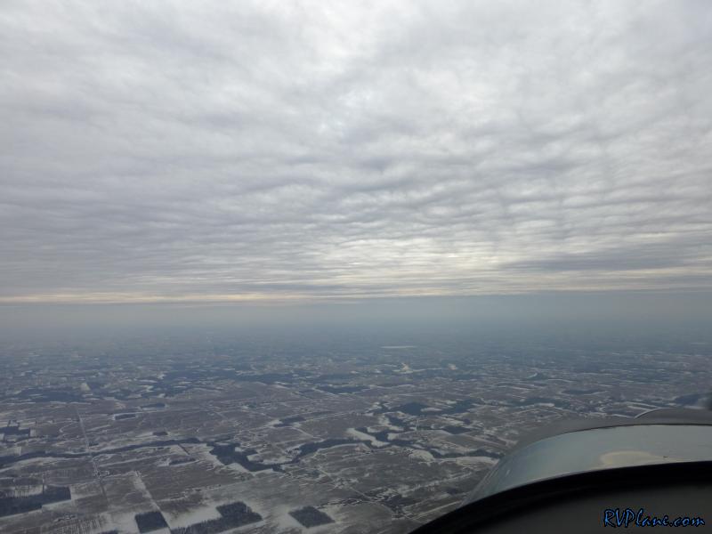 I had some time to play with the Garmin Pilot app with ADS-B on the way home. It has taken me a while to get used to the Garmin symbols, but I really like this setup now. 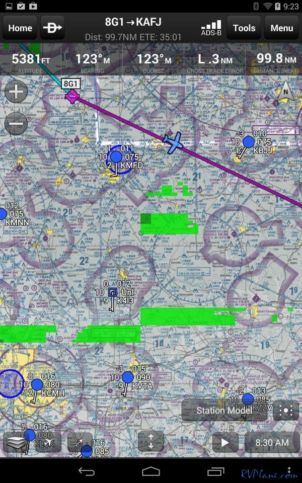 The GDL-39 ADS-B receiver didn't skip a beat. Great ADS-B reception. I have no regrets in switching to this from the iPad/ForeFlight/Stratus combination. 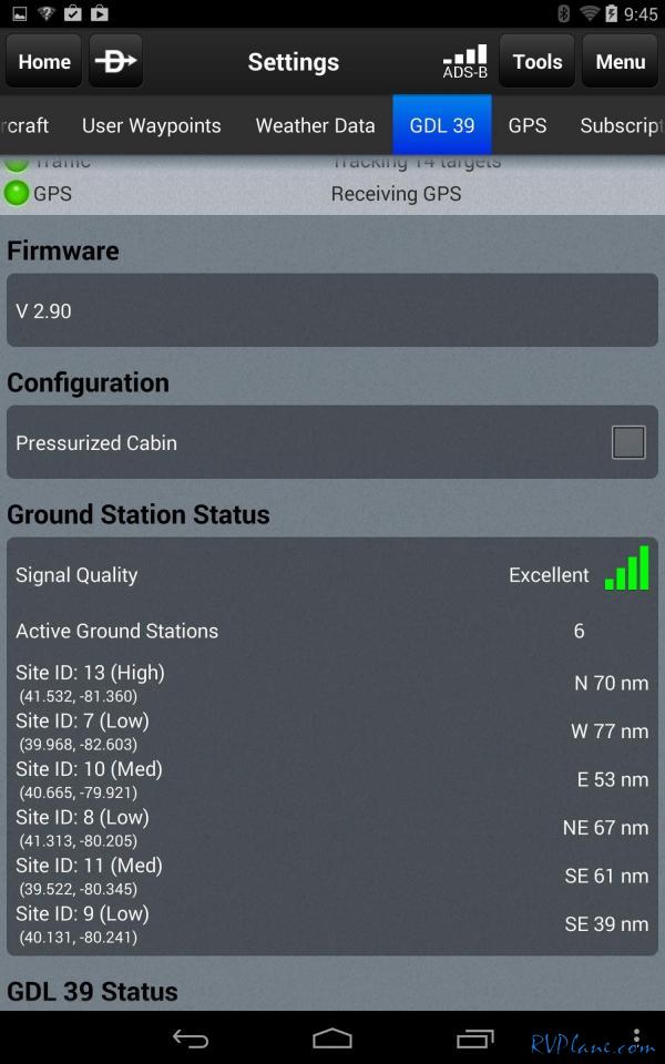 The tailwinds on the way home were great - 24 kts. 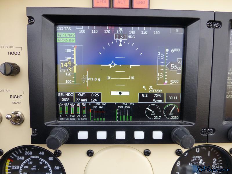 Scooting along at 180 kts (210 MPH!)  I started to play around with the GRT EFIS and found something new - it has a nice built-in log book that has kept track of all of my flights. Even though these EFIS's are over 6 years old, I am still very impressed with them. 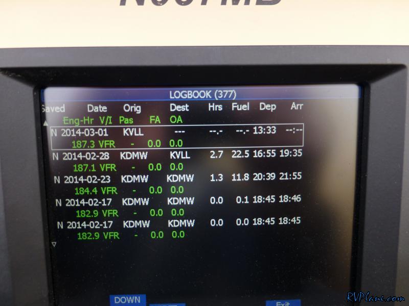 Things kept on getting better...33 kts tailwind! 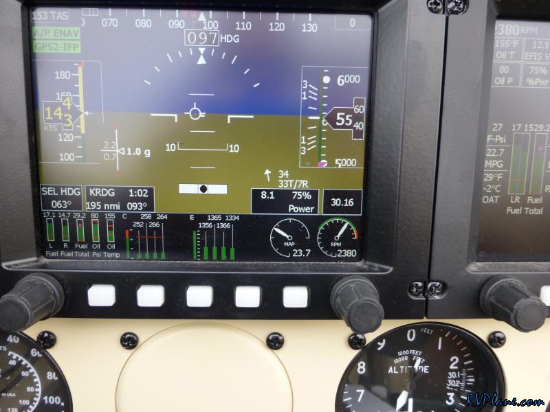 187 kts across the ground! 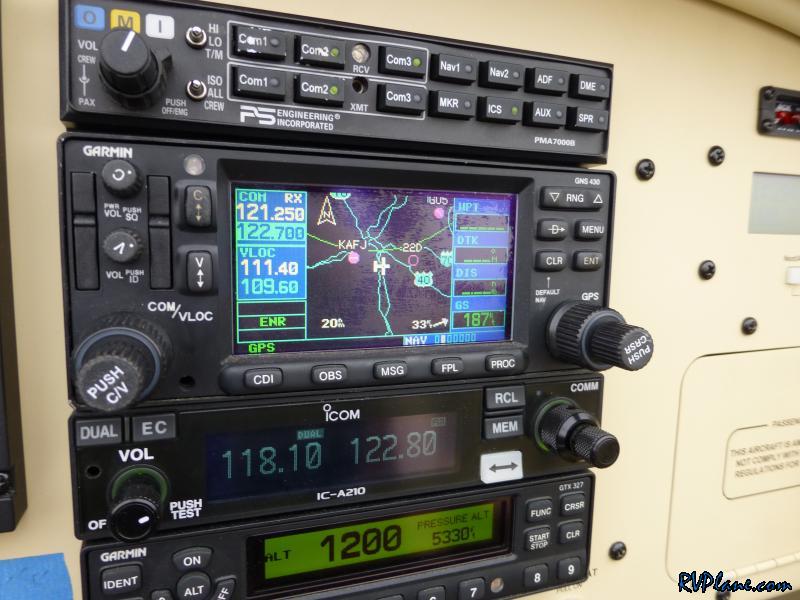 Raystown Lake in PA. It looks like a fun place to be in the summer time. Not so much today. 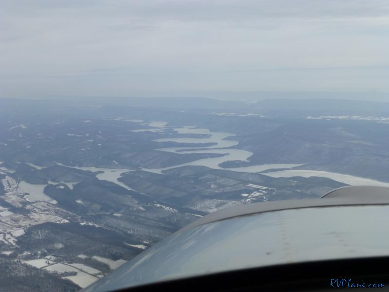 The clouds broke about 1/2 across PA to blue skies. 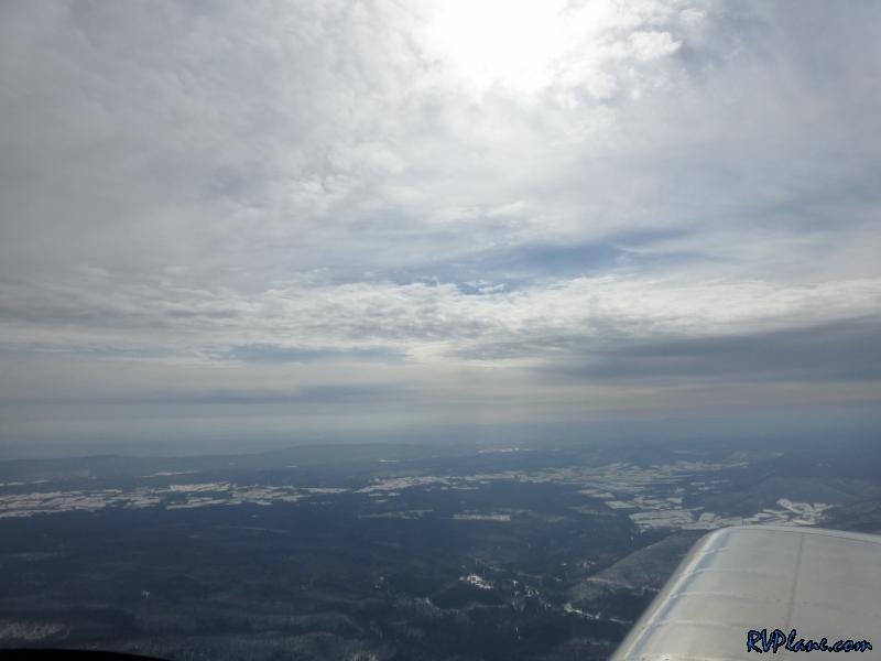 Crossing the Susquehanna river just North of Harrisburg. 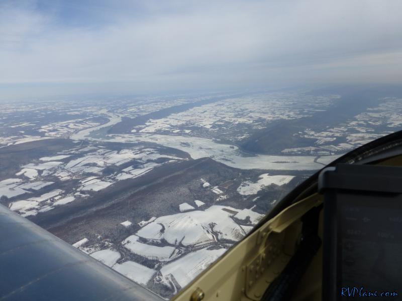 South towards Harrisburg. 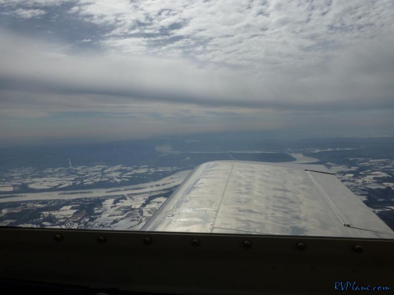 At Reading, PA (KRDG) they have a great flying museum - the Mid Atlantic Air Museum (MAAM - http://www.maam.org). I believe every airplane in here is either in flying condition or being repaired to be in flying condition. This was the most impressive aircraft in the museum - a P-61B 'Black Widow'. The impressive thing about this aircraft is it's history: "On January 6, 1945, a P-61 Black Widow night fighter crashed into the slopes of Mount Cyclops on the island of New Guinea. Forty years later, a team from the Mid Atlantic Air Museum set out to recover the wreckage and restore the rare aircraft to its original flying condition." 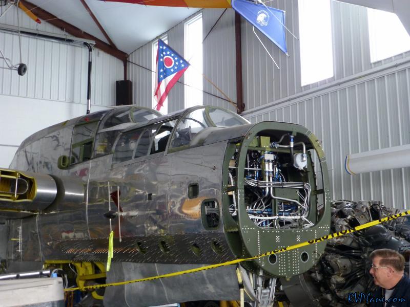 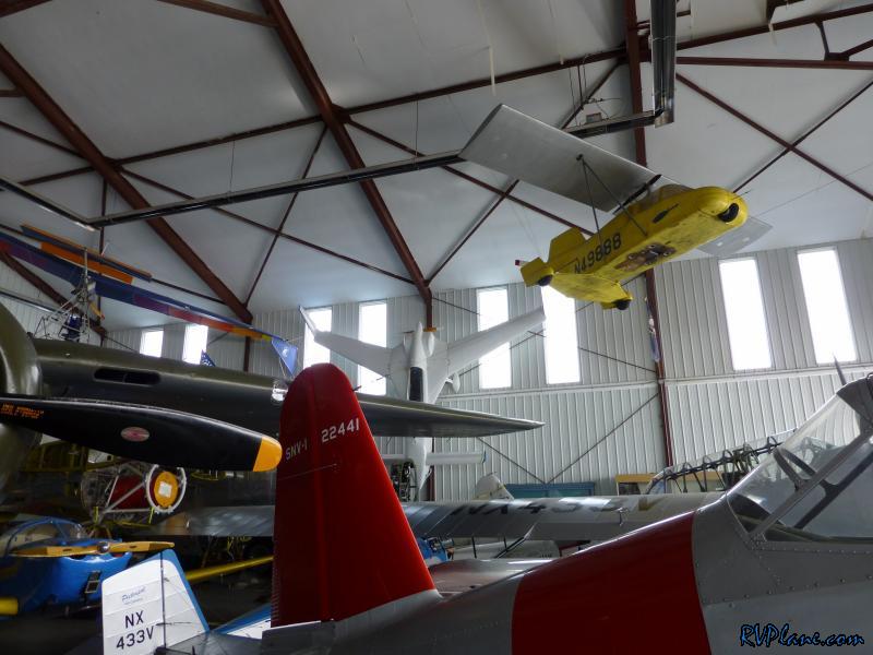 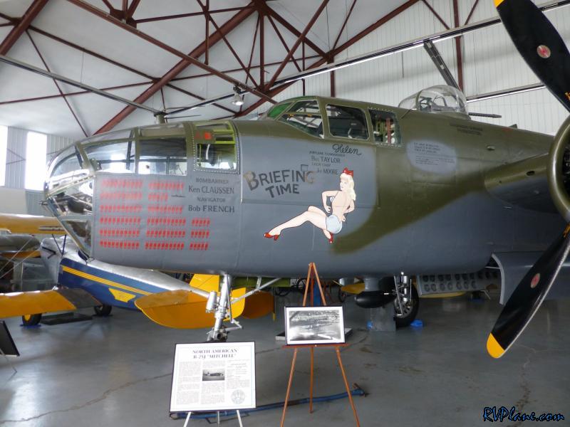 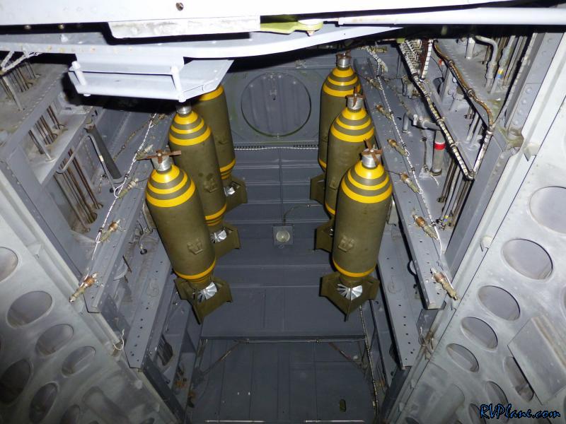 After the museum we taxied to the other side of the airport to grab some lunch. 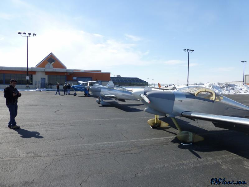 There were three airplanes from my EAA chapter there - a Piper Tri-pacer, RV-4 and my RV-7. We all took off separately, with me taking up the rear. The Tri-pacer was the first one we passed (like he was standing still I might add!). I didn't expect to catch the RV-4, but I forget I run my RV a little faster than most people. Since we didn't brief on a formation flight on the way back, I distanced myself from RV-4 until he saw me and waved me in. We did a very loose formation flight back to KDMW. I don't like doing formation without everyone being on the same frequency or unplanned. 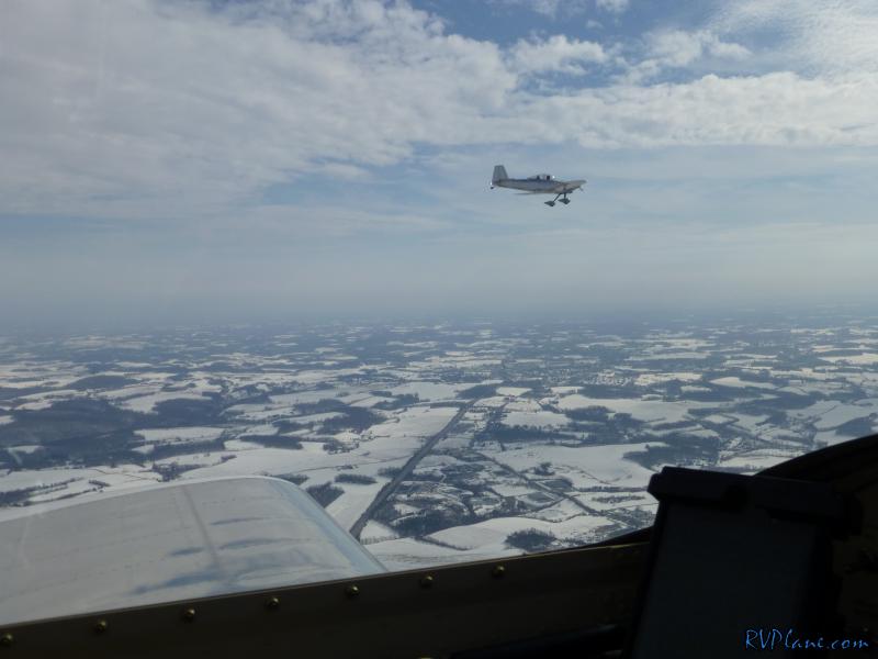 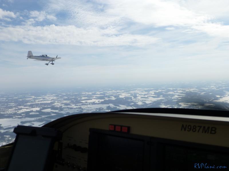 My friend Rishab joined me on the way back from Reading. He loves the visibility of the RV. 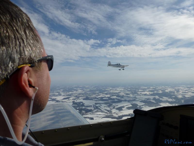 The rest of the trip back was uneventful. Great 2 days in the RV. 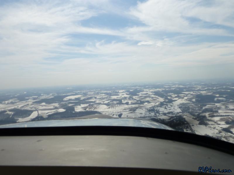 Here are a few shots of all of the airplanes at KRDG that my friend Rishab took. 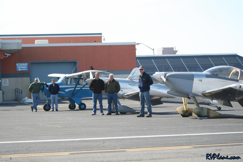 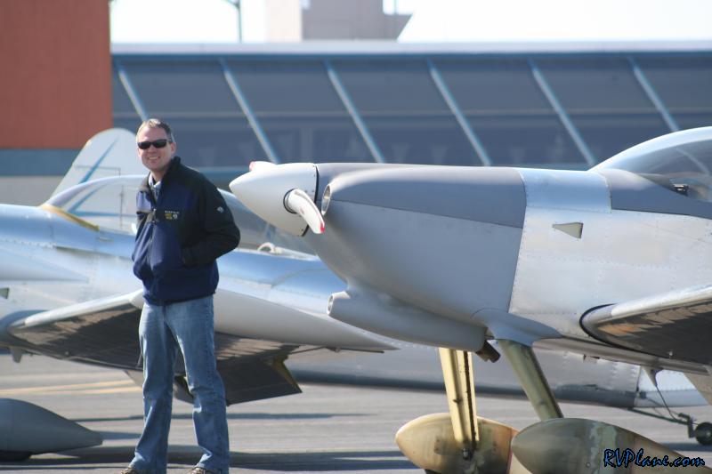 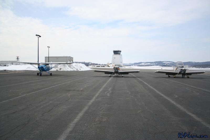 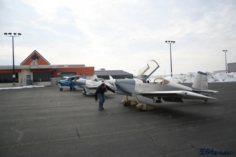
|
|||||
|
http://RVplane.com |
Last Modified: January 31, 2026 |