|
 |
||||
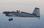
As I mentioned in my last write up from my trip to Triple Tree my CFII friend Peter and I had no luck getting any sort of vertical guidance out of my GTN-650 to my GRT EFIS. Originally we thought it could be since my databases are severely outdated. But the internet disagreed with this theory. I called up GRT today and they turned me onto the holy grail of what I needed - the Garmin GTN650/750 Series Equipment Supplement document (GTN6XXSupplementA1.pdf). I took some screenshots of my before settings. ARINC IN 1/2. 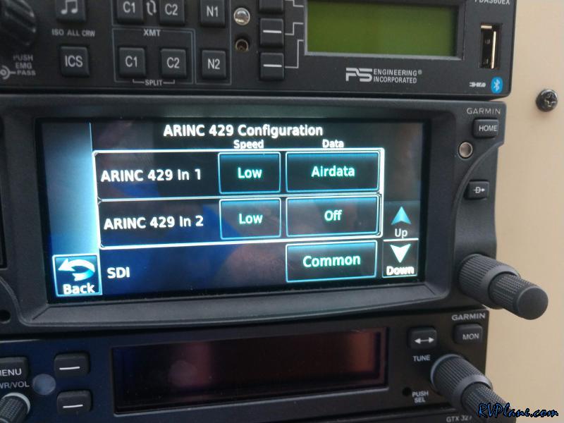 ARINC OUT 1/2. 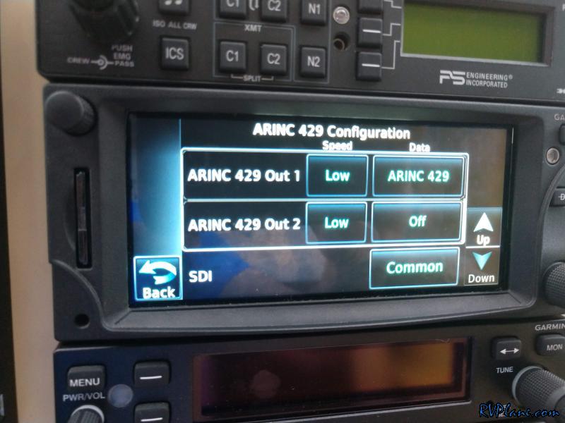 What they should be according to GTN6XXSupplementA1.pdf.  I changed ARINC IN1 from "AIRDATA" to "EFIS Format 2". 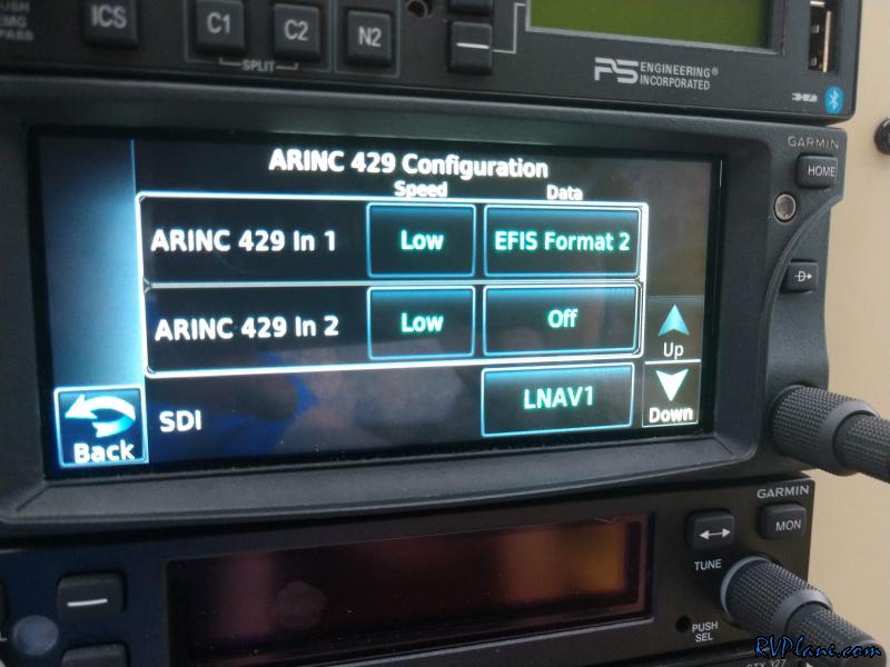 And Out 1 from "ARINC 429" to "GAMA Format 1". 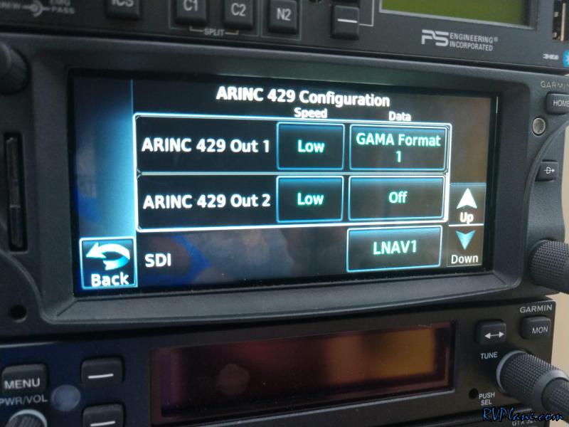 The RS-232 configuration also needed some modification. This was my before setting. 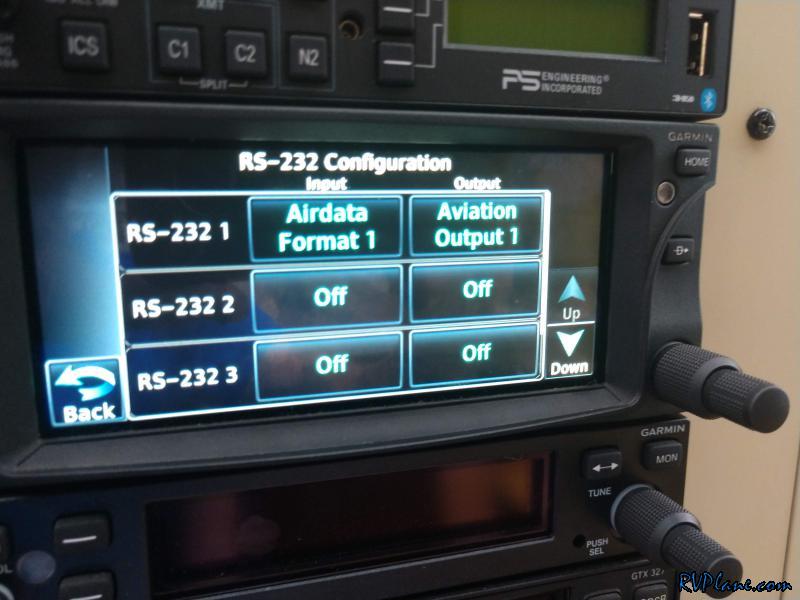 And after setting - RS-232 1 needed to be changed from "Airdata Format 1" to "FADC Format 1". 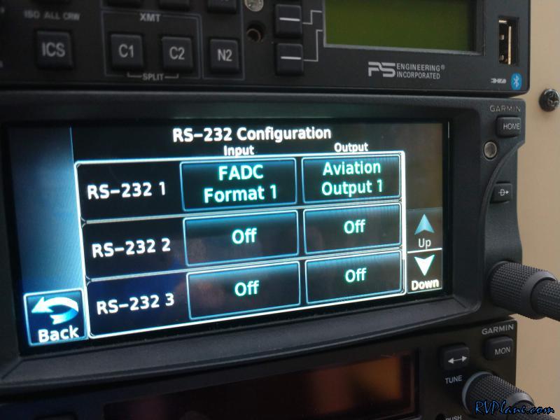 Well, that seemed to do the trick! Upon the GTN starting up it sends an Upper-Left signal to the GRT EFIS. FINALLY IT DISPLAYS IT! 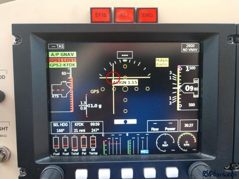 The ARINC debug output also agreed it was getting vertical commands from the GTN-650. 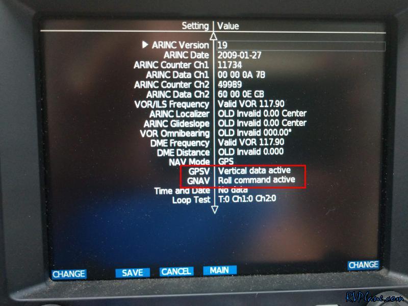 Blurry pic of intercepting the glideslope on a RNAV17 GPS approach to 17 at KTHV. This is HUGE! 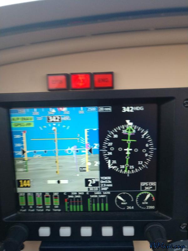 OK, I caved. I bought Garmin Pilot Premium Upgrade today to get my track overlayed on the IFR charts. This is me handflying the approach. 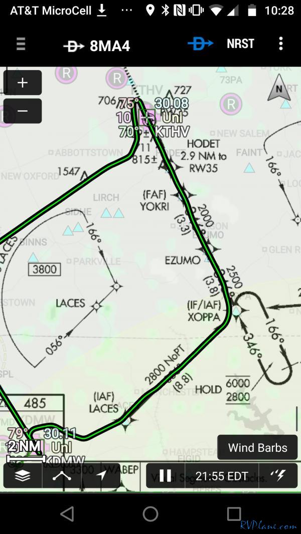 On the way back home I decided to shoot another RNAV. I don't quite know what I am doing yet, but hell, learning is fun. For lack of better terminology in my IFR training infancy, I did a lap around the UNYTS waypoint, and then straight in to runway 16. 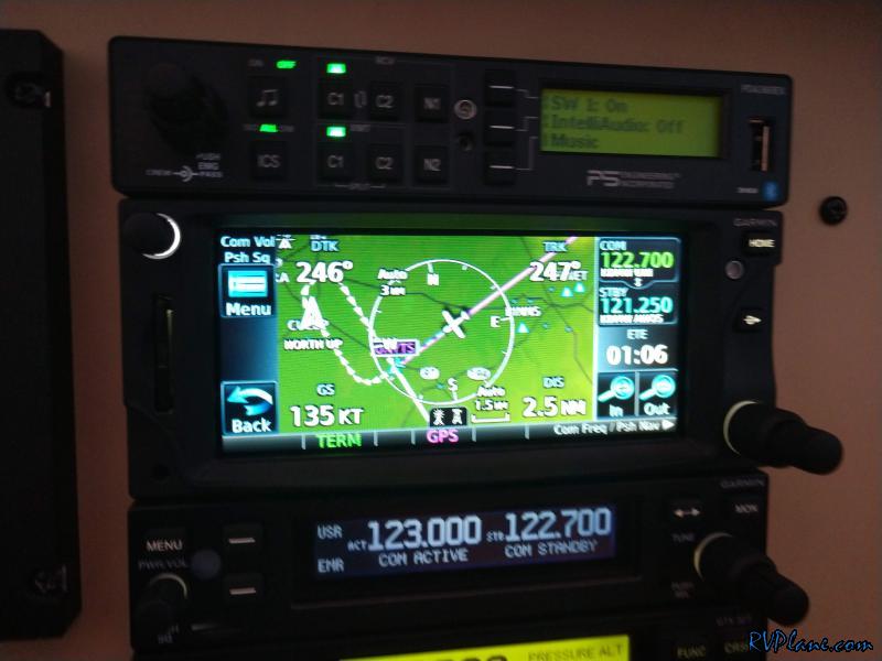 This time I gave the control over to my Tru Trak Autopilot. 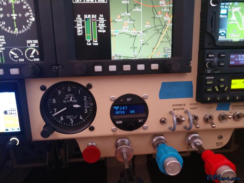 I was super impressed. It captured the GPS RNAV glideslope and flew it down to the runway. 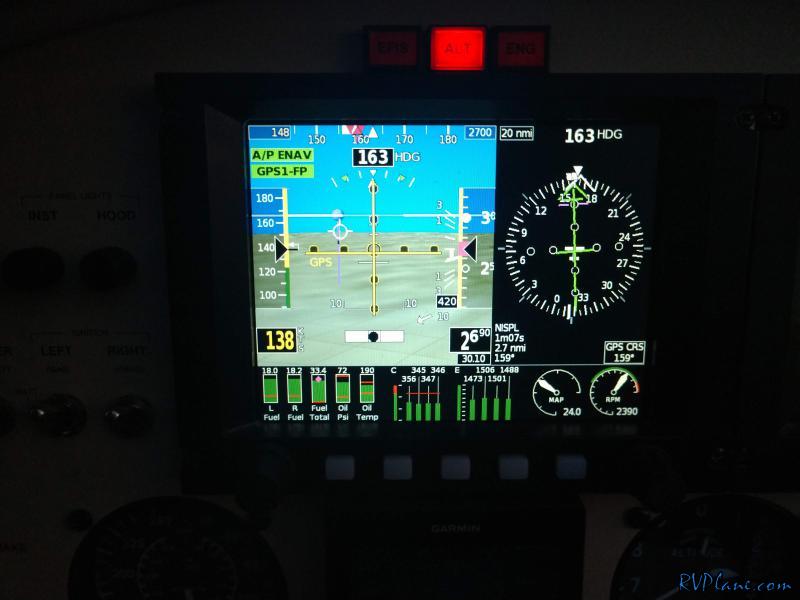 This is 100% an autopilot track. About the only flaw I can see is a slight over-steer coming off from the 339 to 159 degree turn. 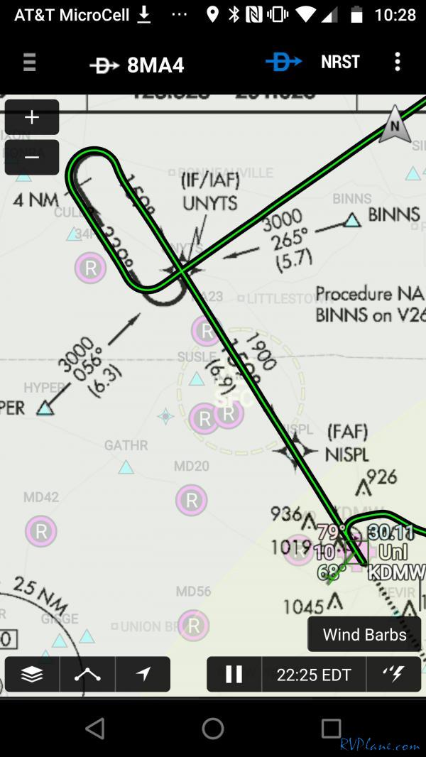
|
|||||
|
http://RVplane.com |
Last Modified: August 13, 2023 |